ベニアジサシ、エリグロアジサシ営巣状況調査
July 7, 2017
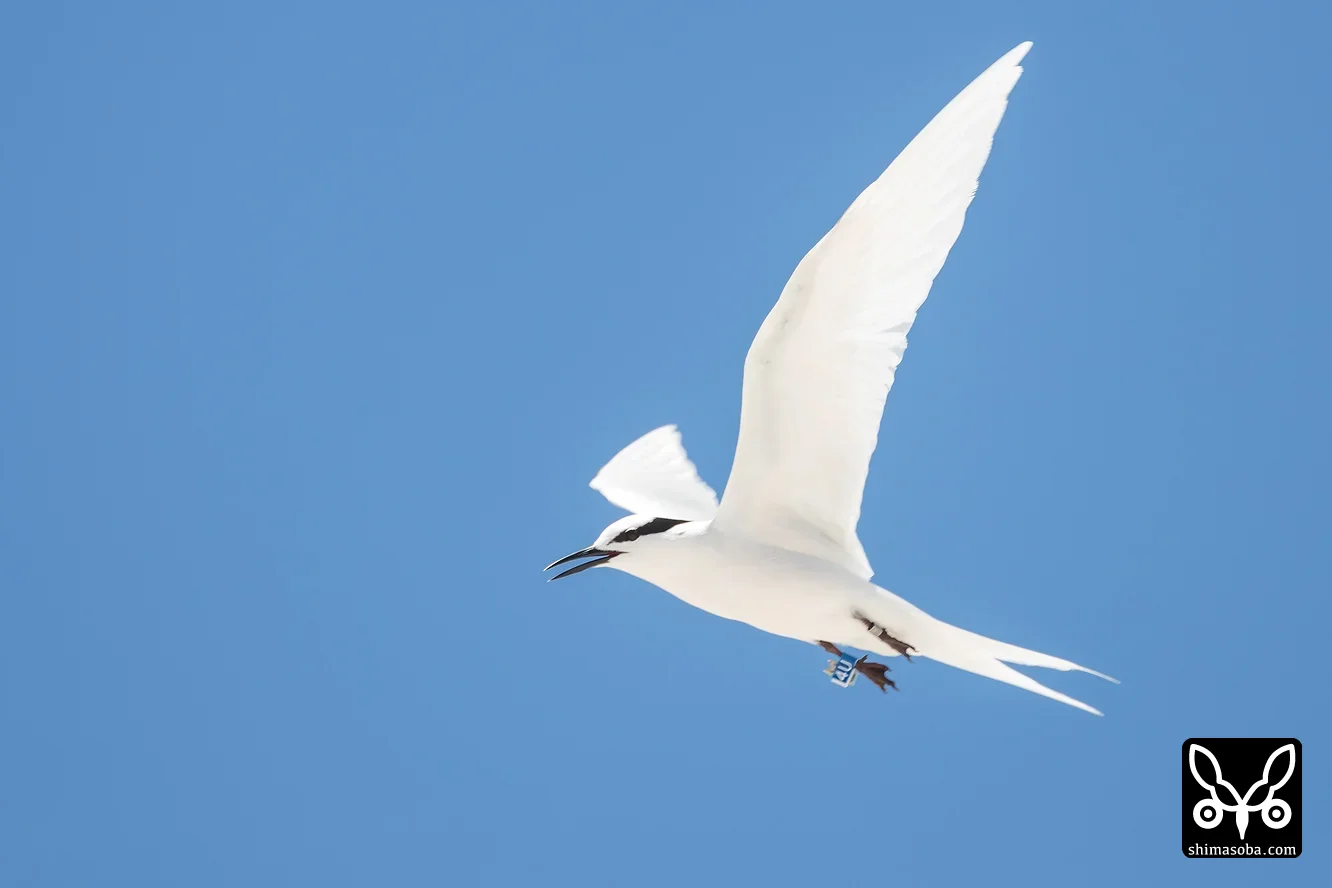
There was a Black-naped Tern carrying a geolocator fitted by the Yamashina Institute for Ornithology. If we can recapture this bird next year and analyse the geolocator data, I think we will be able to get a clear picture of the Black-naped Tern's migration route.
Photos taken nearby (within 200 m)

Capture Data
- Camera
- Canon EOS-1D X Mark II
- Focal Length
- 560.0 mm
- Aperture
- F9.0
- ISO
- 400
- Exposure Time
- 1/500 sec
- Altitude
- 3.2 m
- Elevation
- 2.0 m
- Date & Time Taken
-
July 7, 2017, 1:26 p.m.(JST)
- Original
- 2559 × 1706 px
- Location
- Under adjustment due to policy change
Weather on that day
July 7, 2017 (around the shooting location · hourly)
Max / Min
28.9 / 28.0 ℃
Total precipitation
0.10 mm
Max wind speed
7.33 m/s
Japan Meteorological Agency 那覇 tide gauge station
Photos tagged with this tag:
Black-naped Tern / Ringed / flagged bird